Featured post

Snowdonia Peaks

Monday, 20 November 2017

Lanzarote November 2017

This was our third visit to the Canary Island of Lanzarote for a bit of early winter sun. A really nice place to relax and not do too much, apart from laze by the pool or a cooling swim in the sea as you take in the rays :-) There is though some good walks on the Island and if you like exploring old volcanoes there's plenty to see. We stayed in the resort of Costa Teguise and I did a bit of exploring away from the main town, going along the rugged coast towards a small village of Los Ancones and the cone shaped landscape just beyond it. I also had a walk up the local volcano of Montana Corona which I did the last time we were here in 2013 CLICK HERE FOR BLOG POST and nothing much has changed apart from the wind was a bit stronger this time that made the ridge walk more interesting ! The sun was still shining and it was still warm though :-) I also took a different path back with only a small detour. There are various paths & cycle tracks around here, indeed all over the island so if you like walking/cycling then this is the place to do it. The two walks were straight out of the apartment and both took about 4/5 hours at a leisurely pace taking in the barren landscapes on offer.
Sunday 5th November I did the Volcano walk, straight out of the front of the Apartments.......
Montana Corona from near our apartment
Montana Corona and the barren landscape
Heading along the path that goes round to the right
Cairn at the zig zags
Heading along the ridge
The ridge to the summit
Looking back along the curved ridge walk
The many paths/cycle track around the area
Looking back at Montana Corona
Following the wall back to civilisation
Montana Corona from the road
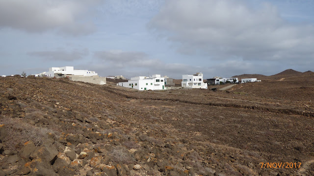
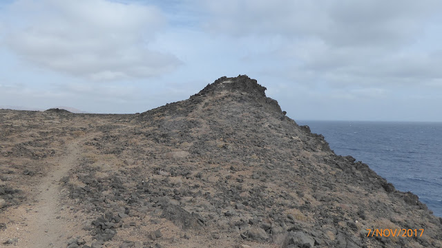
Tuesday 7th November I decided to have a look round the humps and bumps along the coastal path heading away from town as it looked quite interesting. Again, heading straight out of the apartments but this time from the back and heading towards the small village Los Ancones but without visiting it, just skirting past following the coastal path. As with the Volcano walk, the paths are very visible but are a jumble of loose stone solid lava and rocks so some good sturdy footwear is ideal, particularly as there are one or two tops to be bagged so a fair bit of up and down during the day. Today was to be quite ideal for walking round here as a fair bit of high cloud had rolled in taking the heat down a bit and also it was fairly windy as well. It was still warm, shorts and tee shirt but not baking hot, making it quite comfortable.
On the path at the back of the apartments with Montana Corona ahead
On the coastal path with Los Ancones in the distance
Towards the lumps and bumps behind Los Ancones
Passing Los Ancones
I'm not sure if any of the humps have names but most seem to have a cairn or wind shelter that you associate with mountain/hill summits. I loosely call them humps as that is what they seem to resemble along this coastal area, they even look a bit man made but I'm sure there is some history to them out there but I can't seem to find any on the web. They do actually look a lot like Lava Hills, if that's the right terminology, but what ever they are, they made for an interesting walk and in a way it had a mountain day feel about it, or most certainly a day out in the lakeland fells going from one summit to another, I must have visited a dozen or more in the 5 hours I was out with the highest having a big concrete pillar on top that seemed to attract most folk with its two paths up to the top. Most of the others, if you wanted to get to the top like I did, you just went up the scree or a cheeky scramble with not much in the way of any path!! I made my way along the coast path to a large lump of lava rock over looking the sea before doubling back to take in all the summit cones.
Coast path with the humps in the distance
First cairn looking back on my route along the coast
The humpy lumpy landscape
This lump of lava rock is as far as I went along the coast path as it was all downhill onto the next coastal village a few miles away
View back along my route from the lave rock
Large cruise ship on it's way to Costa Teguise Port
View down from the rock
The coast path keeps on going.................
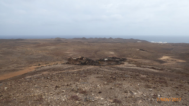
From here I traced my route back and headed for the highest lumps with the biggest cairns on them before heading out from the coast and more inland. I just seemed to make my route up as I went along and as it was clear and the paths were easy to follow I just went for it. I knew what direction I was going so made a route up following more lumps that took me in a sort of circle following the paths and boundary walls. It really is barren and dusty and with all the walls, dry stone ones, it seems like there was quite a bit of land ownership at one time and I even came across a couple of derelict buildings along the way. It certainly looks like a bit of a hard life for some and even harder for any sort of wildlife as I saw very little. The odd bird and lizard but not much else in the dry and dusty landscape.
Making my way up the lava hills
On top with Los Ancones behind
Looking back at the other lava hills and Costa Teguise in the distance
Zoomed in on the apartments and the cruise ship on it's way to port
My next lava hill
Looking back to the coastal lava hills
My next target
From here I made my way across the plain to another small lava hill and then followed a wall for quite some distance. I had noticed an old building on one hill so I thought I'd head for that as it was under Montana Corona and going that way would lead to a good circular walk. As I got further along the wall, I noticed a path that went round that way so it meant at least I could get on flat ground for a bit after walking through what looked like lava fields. There was also one or two other walkers about and some bikers who seemed to be sticking to the paths, unlike me :-)
Another cairn looking back
Follow that wall
Another wind shelter
Follow that wall
Follow that wall
Towards the path
Towards the house on the hill
House on the hill
Looking back from above the house on the hill
From here it was the easy task of going over the last couple of lava hills and through walls that bought me out on the road to the walk back to base and the end of another good few hours exploring this barren dusty landscape.
Last few walls and lumps
Looking back at the house below the hill
An old shelter of some sort
Civilization in sight
Clouds rolling in over the coastal lava hills
back on solid ground with the trees blowing in the now strong wind
Looking back on where I've been
Basecamp

By the time I had arrived back at camp, the wind had picked up quite a bit. That night we had quite a storm with lots of thunder and lightening but no rain!! It's a place that dosen't seem to get much rain at all over the course of a year but it is a windy island with out being cold, cool at night at this time of the year but at least it's dry. If ever you're in this area and don't have access to a car then these two walks away from town are a great way to get away for a few hours taking in the landscape. Sturdy foot wear, snacks and a drink is all you really need but there are also guided walks you can go on if you don't want to venture out on your own.
Another great couple of walks in a different landscape that I'm used to and a great weeks relaxing holiday. It was also a good time to give me knees a bit of a rest and also a bit of a test after a small problem and all seems to be OK now, which is always a good sign :-)
Cheers

Sunday, 12 November 2017

Winter Hill From Belmont, West Pennine Moors 7-10-2017

Well, what a good old yomp across the moors this was, sun, blue sky and the birds singing.... If only!!
WINTER HILL, didn't quite live up to it's name, more like wet and windy hill, but this didn't deter 16 brave souls from the WFP facebook walking group, meeting in a car park on a damp Saturday morning in early October. I'd met a few of the group on numerous occasions and some today for the first time which is always a good thing and as everyone knew someone else it's a good start to getting on with folk. We'd all come from across the UK, 30 minutes for me but upto 6 hours for some and after hello's and catch up chats done we made our way into what can only be described as a wet walk on 't' moors, hence the lack of photo's.
Starting at the Black Dog pub, we headed up through Hill Top Wood that bought us out onto the open moorland as we headed up into the mist. It did start off OK and there was a few bright patches here and there but we all knew that wouldn't last. We got to a good clearing where it was a good idea to get waterproofed up and have a regroup. There is a path but it was a tad wet and quite boggy in places but with a bit of effort we all managed to get to the summit of Winter Hill in one piece :-) Winter Hill is also a TRANSMITTING STATION  with a TV coverage all over Northwest England and North Wales.
Group photo at the start of the walk. Thanks to Lesley for the photo :-)
The locals are used to the conditions
Clear view back to Belmont & the reservoir
Winter Hill trig
Winter Hill trig
I have been up to Winter hill before, but from the direction of RIVINGTON PIKE, so this way was new to me, indeed the whole walk and area we visited is a new one which is always good and will make for a good return in some decent weather one day. A visit to Rivington Pike and surrounding area is always a good half day out, especially on a clear day.
After a bit of bog hopping, it was another wet and slippery walk down, across open moorland and Rivington Road, as we made our way up to our second summit of GREAT HILL which took a good hour to get there. After the initial descent and re-ascent from Winter Hill, it seemed like a straight forward walk that involved quite a distance on stone slabs that made the going easier across the boggy ground. And believe me, this was very boggy and wet but spirits were high. A welcome rest was had at the summit cross shelter where we could at least get out of the wind for a few minutes. Despite the wet conditions, it wasn't constant rain, we did get the odd respite here and there but unfortunately nothing in the way of any decent views of the surrounding area which is always a shame.
Views disappearing
On the slippery slope down........
Looking back to the slippery slope up to a misty Winter Hill
Great Hill summit shelter
From here it was good navigation and knowledge of the area by the organizers as we were led across the bleak and boggy moorland for a few miles where the wind and rain made it quite challenging in the conditions. There was a path of sorts where we followed in single file for most of the way but it was also strangely enjoyable. Not sure I would of found it as enjoyable on my own in these conditions but as a group, it was good to be out. We were heading to DARWEN TOWER or Jubilee Tower as it was originally called, on top of Darwen Hill. Very little in the way of any sort of view, apart from misty moors but we did go through Tockholes Plantation, a wooded area alongside the RIVER RODDLESWORTH which was a good talking point, so we had to wait until we got to the Tower for a view and a well earned rest and food intake.
Into the mist we go
Bog, rain, wind, the perfect moorland companions
Featureless moors
Follow the leader
The world of civilization
The muddy, woody & slippery Tockholes Plantation
Some information I have copied from elsewhere
Darwen Tower. Built in 1897 to serve as a duel celebration. In 1878 5 men were served with writs by the local squire following a provocative Sunday afternoon stroll on the moor. The squire argued that the men were trespassing on private land and frightening the game. The men fought the case and won, so enabling the moors to opened for public enjoyment. The tower also celebrates 60 years of Queen Victoria's reign.
(Interesting note: The campaign to win the freedom to roam across the moors of northern Britain began here in 1878 and at Winter Hill in 1896. Not with the more acclaimed mass trespass on Kinder in 1932).
Great views from the tower
From the top looking down
After another good rest and a bite to eat we made our way back the same way to the main road where we headed along, before re-joining the Darwen Moors and making our way to BELMONT RESERVOIR and the road walk back to the meeting point for a debrief.
Road walk to the moors
Watch out for the bog monsters!!!
A good wild swimming spot :-)
On the way to Belmont Reservoir
Belmont Reservoir
Belmont Reservoir
Well despite the weather, this was again a very enjoyable walk with a great group of people that came in around 14 miles on the soggy boggy West Pennine Moors of North West England and one I'd like to go back to in better weather to see what was missed.
A Big thanks to Wayne for organizing the walk. Thanks to all who came from near and far, the company and a special mention to the two youngsters who just got on with it and never moaned once. Quite refreshing to see and I think the haribo hand outs were greatly received :-)

Cheers