Another Coastal walk that also takes in the Clearance Village of BOURBLAIGE that sits underneath the highest point of Ardnamurchan, BEN HIANT, that we visited when last here in 2017 (click here) A great coastal walk that was a bit squelchy in places but on the whole quite dry underfoot. A couple of small rain showers rolling in but nothing to get too excited about. The walk starts from the small car park and viwpoint that over looks the bay CAMASS NAN GEALL and Ben Hiant. We followed the track down to the old Graveyard & Burial Chamber that looked very diferent to when we visited in 2017. Then it was nice and clear and you could walk round the small graveyard but today was very overgrown and looked quite scruffy which surprised me as I thought a place of this historical importance would be kept quite tidy as a lot of people visit it while staying on the Peninsula. Maybe Covid had a bearing on this, I don't know, but I'm sure it dosen't take much to keep it tidy. Any way, after a quick look round we made our way down to the rocky shoreline and the start of the walk proper, following the feint path round on the edge of the vegitation at the back of the rocky shoreline. All photo's are off my phone camera
 |
Information Board
|
 |
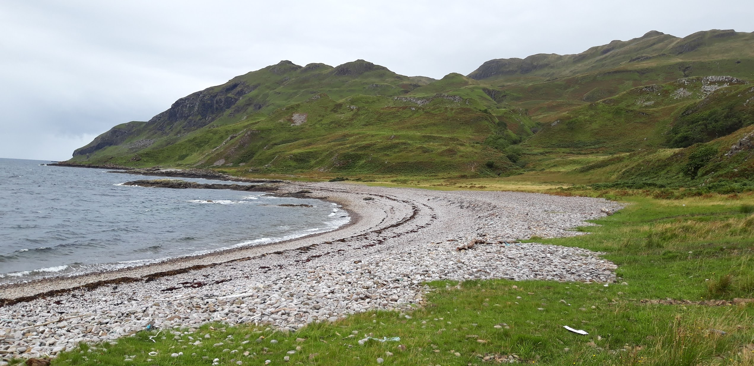
Looking down on Camas Nan Geall from the car park
|
 |
Heading down the track
|
 |
Standing Stone & overgrown Burial Ground
|
 |
The Standing Stone & Burial Ground from 2017 showing how clear it was
|
 |
On the rocky path
|
 |
Looking back to Camas Nan Geall
|
Although the walk is mostly along the rock shoreline, there is a few places where you go up and over a couple of humps and bumps where the ground underfoot was a bit soft after the recent rainfall but fortunately, upto now, it stayed dry. We did come across a small stream crossing from one of the waterfalls coming off Ben Hiant but someone had thoughtfully built a bridge over it to help stay out of the fast flowing water that certainly helped :-) It was when we were walking this next part that we had the pleasure of seeing a couple of Sea Eagles flying around. Unfortunately I didn't have my camera with me to capture them, I only had my phone so I couldn't zoom in on them. A fantastic sight and we did see them a few times during the walk which was a great treat as they are big and majestic birds.
 |
Follow that path
|
 |
Looking across to the Isle of Mull
|
 |
Making our way along the top path
|
 |
Macleans Nose jutting out of the lower slopes of Ben Hiant
|
 |
Rain shower across the Sound of Mull
|
 |
Carefully does it
|
 |
Looking back on the coastal route so far
|
To carry on along the coastline will bring you to the prominent headland
of Maclean's Nose, the promontory where Ben Hiant protrudes into the
sea. We, on the otherhand, got to the point where we headed uphill to the Clearance Village, following a fenceline up the grassy lower slopes of Ben Hiant where it was quite boggy in places. A bit of a pull up after the relatively flat and rocky ground we had been on for the past 90 minutes or so but soon reaching the old stone buildings of Bourblaige. Although they are now getting overgrown with vegitation and the walls are crumbling away, you still get a good sence of how hard it must of been for people to live and work here, probably getting the full blast of the weather blowing across the Sound of Mull and coming down from the slope of Ben Hiant. The area is, in the main, used for sheep and cattle grazing although there are Red Deer that frequent the area so there are a lot of "trails" around the area that were quite boggy. There is also a gully with quite a few trees and bushes growing in it which houses on of the streams that runs into the sea so a bit of extra care will certainly be needed in misty weather. A fascinating place nonetheless for a good look round.
 |
Macleans Nose ahead but we turned off right and followed the fenceline
|
 |
Following the fence
|
 |
First sight of Boublaige
|
 |
The gully of trees and bushes
|
 |
Waterfall coming off Ben Hiant
|
 |
Looking down to the coastal route
|
 |
Ruins of Bourblaige
|
 |
| Ruins of Bourblaige |
We made our way back by the same coastal route we came on, although you can keep on following the fenceline and picking up a route that brings you out on the road further along from the car park to make a circular walk if you wanted. So back down onto the rocky, grassy beach sections as we watched a couple of rain showers passing over the Sound of Mull with only a bit of misty drizzle coming our way as we rested by some amazing looking rocks that had been shaped by the sea and weather over the years. We did pass over the top ground of these but found a way down to the shore to a little cove where we had a rest out of the wind and drizzle. We did spot the Sea eagles again and a couple of Deer but no other wildlife. We were hoping, again, to spot an otter but as the tide wasn't very calm, it would of been a looky spot to see any.
 |
The way down
|
 |
Rain shower passing through
|
 |
The rocky coastal path
|
 |
The shepherdess of Ardnamurchan
|
 |
Through the rocks
|
 |
Exploring the sculptured rocks
|
 |
Sculptured rocks
|
 |
Sculptured rocks
|
 |
Sculptured rock bay
|
We made our way out of the small cove and got back on track following the path and got back to the final stretch just as the rain started to come down and bit more. Another good 4 hours covering around 5 miles of this fascinating place with a good bit of history thrown in. Despite the overcast conditions, it was an enjoyable walk that only presented two obstacles in the way of water crossings, one easy, one not so but both done without any mishaps thankfully :-)
 |
Isle of Mull looking all clear now
|
 |
On to the last bit of rocky beach
|
 |
The last water crossing
|
 |
Rain coming in off Ben Hiant
|
 |
Rain coming in across the Sound of Mull
|
A recommended walk if ever you find yourself in this part of the world
MY VIEWRANGER TRACK


