Another last minute decision saw us drive up to
BORROWDALE in the Lake District for a camp out and a walk up to
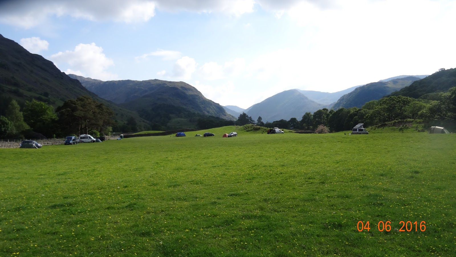
CASTLE CRAG. Although I have been here before, it's a first for Jill and we were blessed with good warm sunny weather for the most part. We didn't leave home till after midday and arrived at the campsite about 3.30pm, got the tent set up and had a walk round the tiny hamlet of Rosthwaite, where the home made ice cream is very nice :-) and down to the River Derwent that runs along the field where the campsite is. A beautiful place surrounded by some of the high Lakeland fells.
 |
| Campsite surrounded by the fells |
 |
| Oh, the joys of camping :-) |
 |
| Hamlet of Rosthwaite. Ice cream shop is the last cottage where the sign is |
 |
| Lovely :-) |
The walk up to Castle Crag on the Sunday was at a leisurely pace as we were in no rush to leave and as it was a there and back of four miles, no need to rush. It was warm, very warm and a bit muggy as the blue sky of the morning was disappearing and it was very hazy. The route was straight from the tent, across the river by the National Trust campsite and up through Jonnys Wood & Scaleclose Coppice. There should be a waterfall at Scaleclose force, but as there was little or no water in the becks and rivers, no waterfall!!! Oh well, we imagined it instead and it looked good :-)
(As my camera battery had almost died, most photo's are of my phone)
 |
| Our route for the walk |
 |
| Castle Crag from Jonny's Wood |
 |
| On the way to Scaleclose Coppice |
 |
| The foot bridge over the very empty Scaleforce Beck |
 |
| The very empty Scaleclose Force waterfall |
 |
| There should be a waterfall but as you can see by the rocks below, the beck is empty |
Out of the Coppice and up to Tongue Gill where a few paths meet up going in all directions leading to the surrounding fells. I'll get back here sometime for a good look round one weekend as it seems quite interesting with old quarries dotted about.
 |
| Castle Crag getting nearer |
 |
| Wooden bridge over Tongue Beck, although it really wasn't needed today |
 |
| View back down to Borrowdale from Tongue Beck |
The path is very straight forward to follow and the only real steep/ tiring bit is the ascent up the old slate spoil heap. It looks impossible to climb but there is a zig-zag path going up the the top. The actual summit is a further 2 min climb up among some tree roots to the level platform the offers great views down on Derwent Water, across to Rossthwaite Fell and back down to Borrowdale. There is also a memorial on the summit for the men of Borrowdale who lost there lives in World War 1
 |
| The slate spoilheap with the zig-zag path on the left |
 |
| View down to Borrowdale from the top of the spoil heap |
 |
| View up to the summit from the spoil heap |
 |
| Slate quarry pit |
 |
| Summit War Memorial |
 |
| Taking in the hazyview down to Derwent Water |
 |
| Hazy summit view down to Jonny's Wood |
 |
| Hazy summit view down to Derwent Water |
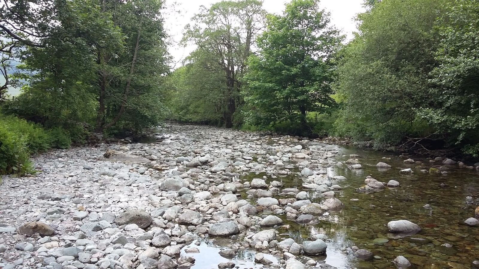
After about half an hour we made our way down the steep ascent that brings you on the banks of the River Derwent or what should be the River!!. More like a dry river bed with the lack of rain over the last few weeks. There was water and we even spotted a few fish in some deeper pools but on the whole it was really lacking in water. We did pass a bridge that had a sign and some barriers on it warning people to take care on the bridge as it had been damaged by the winter floods. Fromone extreme to the other!
 |
| Looking back at the descent path through the woods |
 |
| Warning sign on the damaged bridge |
 |
| Damaged bridge over the empty river |
 |
| Empty River Derwent |
 |
| Empty River Derwent |
 |
| Who nicked all the water!!! |
A straight forward walk back to the campsite ended another great day out in the Lake District. Great campsite, great weather, great walk and excellent company :-)


No comments:
Post a Comment