I'd looked at this walk for sometime, after doing St SUNDAY in the snow last November and wanted a revisit in the warmer months of the great British summer! I thought I'd tie it in with a re-visit to HELVELLYN, via STRIDING EDGE, as I'd not been up here for a few years and just fancied a nice bit of scrambling along with everything else that this walk threw at me. A lot of up and down and some fine views. Sunday seemed to be the pick of the weekend weather wise so an early start on empty roads saw me parked up at GLENRIDDING for 8.30am in good clear sunny conditions that stayed for the most part, only clouding over around midday for a few hours. The route I took was out of Glenridding following Mires Beck and up to RED TARN where I headed along Striding Edge to Helvellyn. Along to NETHERMOST PIKE, HIGH CRAG, DOLLYWAGON PIKE, down to GRISEDALE TARN, up on to St Sunday and back down into Glenridding. Around 10 miles in good clear conditions. :-)
My route for the day
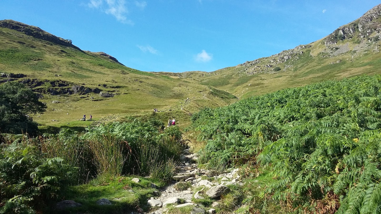
I'd forgotten how hard it was making my way up the road, past the houses and following the beck and it required a few stops along the way for liquid intake. Despite Glenridding car park being quite busy and also Gillside Campsite being full, there wasn't that many folk making there way up here. It was quite surprising given the weather conditions as the last time I was here it was very busy in similar conditions. Some good views back to Glenridding the higher I got before reaching the top of the wall where you get a good view of the Helvellyn Range and also across to my descent route of St Sunday.
The warm and quiet way ahead
Looking back down on Glenridding
The Helvellyn Range
Looking across to St Sunday
On my approach to the "Hole in the Wall" I noticed a group of about 10 just setting off on their way along the edge so this was a perfect time for a good rest to let them get ahead before making my way over. There are two ways to do Striding Edge, the more direct way is straight over the crest keeping as high as you possibly can or the more safer and less exposed way is to stick to a path a few metres below. In this weather and for more excitement, I took the high route and as there was no wind it was a comfortable walk/scramble to do. As always on these ridges, care must always be taken as there are steep drops and accidents can happen but with care and confidence all should be fine.
After about twenty minutes rest I started on my way by first following the fient path up the grass bank and getting amongst the boulders and rocks early on as a few others stuck to the path below. Another reason to go higher is that you get more views of the surrounding fells and valleys and in the clear conditions made it more worthwhile. Going this way you will also come across a memorial to commemorate Robert Dixon from the nearby village of
Patterdale who fell to his death on the ridge back in 1858. The
inscription on the memorial plaque reads: “In memory of Robert Dixon of
Rooking, Patterdale who was killed on this spot on the 27th day of
November 1858 following the Patterdale Foxhounds”. A kindly reminder that it can be a dangerous place.
Setting off along the grass bank with the main path below
Getting amongst the rocks and boulders
The Dixon Memorial
Striding Edge
Looking back along the Edge with the main path below
There was a bit of a hold up at "The Chimney" as you come off the Edge as folk take a bit more time to negotiate the climb down. Just a bit awkward as you find the right foot and hand holds and can prove to be a bit of a sting in the tail at the end of the ridge. This part also signals the climb upwards as you scramble up to the summit. Again, not difficult in the conditions but in wet and misty weather extreme care should be taken. As you top out there is another memorial that was erected in 1890, in memoriam to a fatal accident in 1809.
Charles Gough was a Kendal man who was out for a walk with his dog, when
he was killed in a fall on Striding Edge.Another timely reminder...............
The Chimney
Scramble up to the summit
Looking back down on Striding Edge and Red Tarn
The Gough memorial
The plateau of Helvellyn is a long and wide flat place that offers 360degree views that can stretch all the way to the coast of South West Scotland, Isle Of Man and even North Wales. Although it had been a good clear blue sky day up till now, high cloud started to move in that restricted any far away views but at least all the tops were well clear and it was still quite warm with very little wind. It was also a very quiet summit which is a surprise as Helvellyn is quite possibly the most visited of all the Lake District fells, and it's only the third highest @ 3117ft behind Scafell @ 3163ft and the Highest summit in England, Scafell Pike @ 3209ft. A relaxed summit with folk making their way to different points, people taking in the views and some taking in a summit pic-nic. After taking in the summit views I made my way to the next target of Nethermost Pike.
Summit views of the high peaks of the Scafell & Bowfell range
Summit view down to Red Tarn with Striding Edge on the right & Swirral Edge on the left
Helvellyn Summit Trigpoint
Helvellyn Summit
Helvellyn Summit
From here I followed the straight forward path taking me to another flat summit plateau of Nethermost Pike. With the cloud cover and a bit of a breeze, the temperature had come down a notch or two enough for an extra layer and it was also the first time on the walk that I was completely alone. There is another path that seems to divert away from the true summit area and there was one or two people taking that route. I stuck more to the ridge line following that round and indeed the next two summits of HighCrag & Dollywagon Pike, I was the only one on them at that time. Turning out to be a very quiet Sunday afternoon :-) It's a downward spiral all the way to Grisedale Tarn as you come off the summit of Dollywagon Pike, a drop of about 1000 ft and it certainly takes it out on you, it did me , that's for sure and it was a welcome break of about half an hour sat next to the tarn. One way of getting down is on a bike and two mountain bikers looked like they were having fun making their way down, certainly quicker if a bit bumpier but they seemed to enjoy the ride!
Looking over to Striding Edge with a few more people on it
Zoomed in on Striding Edge
Nethermost Pike Summit Plateau
Nethermost Pike Summit Plateau
Looking back at Nethermost Pike, Helvellyn & Striding Edge from High Crag
High Crag
Looking over to Dollywagon Pike from High Crag
Dollywagon Pike Summit with High Crag in the background
View down on Grisedale Tarn with the MTB'ers on their way
The zig zag path down to the tarn is hard going, as for the most part it's stone steps all the way so a bit hard on the old knees. It does drop quite sharply and I did pass a few people making their way up which I would of found hard going so I took comfort at that and also being able to have a good rest at the tarn before heading up a relatively easy sloping path beneath Cofa Pike taking me onto Deepdale Hause and onto St Sunday Crag. I wasn't alone at the tarn as its a place where half a dozen paths meet from different directions making it an ideal place to rest before continuing on your chosen journey. It wasn't overly populated with only half a dozen of us taking in the relative peace of the place. A really nice place to have a leisurely late lunch :-)
Grisedale Tarn with Seat Sandal as the backdrop
My way up to Deepdale Hause & St Sunday Crag
Looking back down on Grisedale Tarn from the path
A Panoramic view of my route from Striding Edge on the right to Grisedale Tarn on the left
Grisedale tarn from Deepdale Hause
My way up St Sunday Crag from Deepdale Hause
The path up to Deepdale Hause is straight forward enough and going up at an angle gives a bit of a rest bite than going straight up and as there is one more push up to the summit of St Sunday that was a bit of relief. a feint path in places but easily picked out. The path up St Sunday is also straight forward enough as it heads up the ridge offering good views all round. From here it was down towards Birks before heading off to the left and following the path going under Birks and this is where me knees started to feel todays outing. Not painful, more uncomfortable as the path goes from rough scree, grass and stone steps and it is quite a long way down so plenty of stops were needed and I was glad to get down on more level ground.
Looking across to Fairfield
Looking down in to Deepdale Common
On the way to St Sunday Summit
Summit view down to Ullswater
View down to Birks and my way off the summit
Looking back to St Sunday
Looking back at my high level route
Ullswater
Grisedale Bridge
Ullswater with Place Fell as the backdrop
A road walk back to Glenridding and the car left only one thing to do as it was such a good warm afternoon and that was to have a ice cream while sitting and relaxing for a bit next to Ullswater. A perfect end to yet another perfect day :-)


No comments:
Post a Comment