This is a walk that I have been meaning to do for a number of years but never got round to it for one reason or another. I have, of course, been on part of the
BOLLIN VALLEY WAY around the Hale/Manchester Airport side, hundreds of times as I grew up in the area and still walk round there quite reguarly. It's my favourite low level walking area and never tire of it whatever time of the year and always something see on the nature side of things. Since the world was turned upside down with Covid 19 playing havoc and people only being allowed to travel local for a few months, I started to seriously think about doing this 25 mile walk while the going was good. So the planning started with getting the appropriate OS map
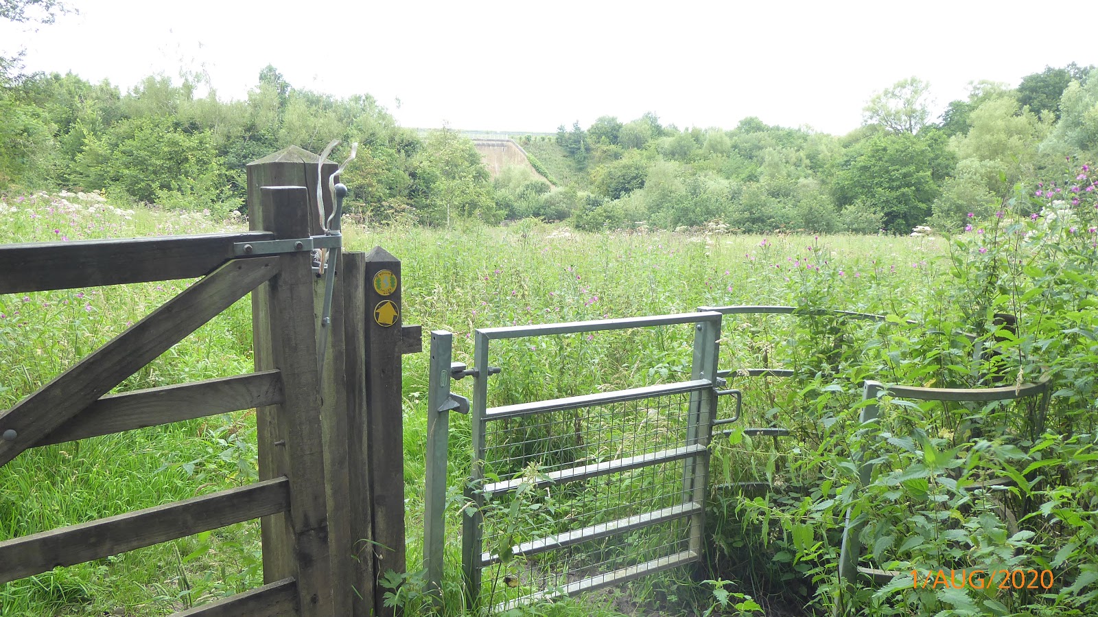
(os268), sending off for the three leaflets that describe the sections in good detail along with a mapped route. Although the whole route is signed with good signage, it does overlapp with the
NORTH CHESHIRE WAY long distance path and also quite a few localised public footpaths that can make it a bit confusing and end up going the wrong way if you're not careful. Once you get familiar with the BVW logo and arrow pointing the way, it does make it easier to follow. Having said that, some of the paths that aren't as well used can get a bit overgrown so the signs can get a bit obscured of view so having the map/leaflets at hand is always a good idea. The going is always moderate on this stile free walk, there are quite a few gates to go through though and the paths on the whole are good to walk on and mostly fairly flat as you are following the course of the
RIVER BOLLIN from
MACCELSFIELD to
PARTING TON. The walk not only follows the river but you do have to cross one or two busy roads, walk through farm fields that have sheep, cattle and horses in them, go through wooded areas and also through the Manchester Airport Runway tunnel and the M56 tunnel. If you like a bit of plane spotting then you'll enjoy the part that brings you to the end of runway one where the planes go right over your head.
So with restrictions being relaxed and people allowed to get outside of there immediate vacinity, I decided that Saturday 1st August would be a good day to do this walk, or at least 2 thirds of it, saving the final 9 miles for the following Saturday, 8th August. It was going to be a long day as I had to get the Metro into Manchester then a train into Maccelsfield and then walk a mile or so to the start of the walk at
MACCLESFIELD RIVERSIDE PARK. I set off from the Riverside Park at 10.45am on a good day for walking, a bit overcast, a light breeze and warm. The first section is probably one of the flattest as you start on a good maitained path before getting into fields where there was a small herd of
LONG HORNED CATTLE resting, following the River Bollin in to
PRESTBURY it was also along this stretch that I saw a pair of Kingfishers flying over the river, a great sight to see as they are very fast and you normally only see a flash of blue as they fly silently by. With the paths being good and flat and plenty of open space, there were quite a few people out making the most of the decent weather, walking dogs and folk getting in some excersice to start the weekend off on a good note.
 |
| Bollin Valley Leaflets |
 |
| Bollin Valley Leaflets |
 |
| Start of the Bollin Valley Way |
 |
| Flat path at the start |
 |
| Trainline next to the path |
 |
| The river Bollin at the start of the Bollin Valley Way |
 |
| Path along the River Bollin |
 |
| In to the Cattle grazing fields |
 |
| Long Horned Cattle |
 |
| A very low River Bollin |
 |
| Quite a bit of erosion taking place along the river bank |
 |
| Information Board |
 |
| I saw quite a few small fish in here |
 |
| On the approach to Prestbury Village |
 |
| In to Prestbury |
 |
| Prestbury Village |
 |
| Prestbury Village |
Crossing the road and down past some houses with the river on your left, you pass through more fields, go through gates, through small patches of wooded areas, pass the water treatment works before crossing a narrow wooden bridge that takes you on to the Mottram Hall Estate and along side the golf course. Following the path and leaving the golf course, heading across more fields with sheep and cattle grazing, you have to cross another road, not busy, at Mill Lane Bridge to get on the right hand side of the river.
 |
| Note the slatedbed of the River Bollin |
 |
| Through more farm fields |
 |
| Sheep crossing point |
 |
| Past the water treatment works |
 |
| Through the woods |
 |
| Past the water treatment works |
 |
| Through more woods |
 |
| River Bollin |
 |
| Heading straight across the field to the wooden bridge |
 |
| Over the narrow bridge |
 |
| Past the golf course |
 |
| Fungi on the trees |
 |
| Herd of Long Horned Cattle taking it easy |
 |
| Coming upto Mill Lane Bridge |
 |
| Mill Lane Bridge |
 |
| Mill Lane Bridge |
Following the path through more sheep fields I headed away from the River Bollin as I headed towards a farm where the path seemed to take me through the front garden although there was a track that would of bought me out at the same place as the official BVW path, although I didn't realise this at the time. Good job the farmers family weren't in the garden enjoying the up to now fine weather :-)
The path eventually leads back down to the river where I found a good spot for a rest and something to eat. As I had left the villages behind, this part of the walk was very quiet and I didn't see any one else untill I left the river again as I came into
WILMSLOW.
 |
| Heading towards the farm |
|
 |
| Over it or round it!! |
 |
| The path through the farmers garden! |
 |
| Looking back at the BVW path on the left and the track on the right |
 |
| Through the sheep fields |
 |
| Lazy sheep |
 |
| Heading through the trees |
 |
| Nice place for a rest |
After about 20 minutes rest and refuelling, I set off following the river heading to Varden Bridge and Wilmslow Park but by now the weather suddenly turned a bit damp. Not heavy rain but that annoying drizzle that seems to soak evreything before you know it. It was still warm though and luckily the rain had stopped by the time I reached
CARRS PARK WILMSLOW. Thankfully, this was the only rain of the day. Along this stretch was more evidence of the erosion to the riverbank by the weather and the rising river levels. Although the river is only small and in a lot of places very shallow, it does suffer from erosion quite a lot as it snakes through lots of fields. Some parts of it do flood quite a lot after heavy rain and I do know that a lot of trees and bushes have been planted in parts to help with this but around this part of the Bollin the banks are practicually the same hieght as the fields which dosent help, especially when farm animals are grazing.
 |
| Through the gate or round it ? |
 |
| Riverbank erosion |
 |
| Heading into the flood plains |
 |
| This area can flood quite easily |
 |
| Varden Bridge, a listed building |
 |
| On through Wilmsolw Park |
 |
| Wilmslow Park Wier |
 |
| Crossing another road to get in to Wilmslow |
 |
| Coming out of Wilmslow Park |
After leaving Wilmslow Park, there is a bit of road walking going through the A34 tunnel, under the Wilmslow Viaduct Arch, past the St Bartholomew's Parish Church, which dates from the 16th Century, past the war memorial gardens and down in to a place called
THE CARRS. The Carrs was by far the busiest part of the walk as it's a great place for familys to enjoy a kids park, pic-nics on the large areas of green grass by the river, good paths for all to enjoy the river and woodland walks. Oh, and there was an ice ceam man there today so it had to be done :-) You can walk to the
QUARRY BANK MILL in Style from here as well as shorter walks. I have walked all round Quarry Bank and that part of the Bollin on many occasion over the years through the woodland but todays walk dosen't head that way as I was to head along the river towards Twinnies Bridge about a mile away.
 |
| Under the main A34 in the rain |
 |
| Wilmslow Viaduct |
 |
| St Barthlolmews |
 |
| Memorial Gardens |
 |
| Entrance to The Carrs |
 |
| Happy face 99 :-) |
 |
| The River Bollin through the Carrs |
 |
| The Carrs |
 |
| Twinnies Bridge |
Although Twinnes Bridge car park was quite full and there were quite a lot of people about, my route on the BVW was back to being very quiet again as most people used other paths or were going towards The Carrs. This next part of the BVW was a bit more exciting and also the main part for lots of up and down as it weaved it's way through a lot of woodland with quite a few stairs and also a lot of boardwalking. In a strange sought of way it remained me of some of the walks I have done in Australia through the rainforests along boradwalks, which there are many, mainly to keep you straying along the forest floor protecting all the flora and funa thats out there. Here I thinks its more a case of keeping your feet dry :-) It is also a part where you leave the Bollin behind and go through more fields and woodland, crossing two roads, going though farmland before re joining the Bollin at the tunnel that takes you under Manchester Airport Runway Two and part of the Runway Two Trail, another walk I have done many times in the past.
 |
| Leaving the River Bollin behind as I head up into the woods |
 |
| Along the Boardwalk |
 |
| Along the Boardwalk |
 |
| Up the stairs in the woods |
 |
| Along more boardwalk |
 |
| Across the road |
 |
| Through farmland |
 |
| Through farmland |
 |
| Past some nice cows :-) |
 |
| Past some houses |
 |
| Needs a bit of tidying up |
 |
| Across the bridge and up the stairs |
 |
| Getting a bit overgrown here |
 |
| Through the gate towards the Runway Tunnel |
 |
| Airport Runway Two Tunnel |
I was now on very familiar ground as I had another rest for 15 minutes or so. From here, through to the Hale Golf Club was one part that I didn't need to check which path to take, and there are a few as it criss crosses with the Runway Two Trail, The North Cheshire Way and quite a few footpaths around this part of the Bollin. A good place to spot kingfishers here, although I didn't see any more today, it is a good place to see them. The tunnel is also a wildlife corridor and also a place where bats and other flying insects can rest up as there are some roosting boxes along the roof of the tunnel. There are also a few information boards along the way explaining how the building of the runway and tunnel helped maintain lots of ponds and wildflowers to grow in and around the area. If you like planes then this is a great place to hang about watching them take off and sometimes land coming right over your head. Today, because of Covid-19, was very quiet with only a couple landing at the far end of the runway. Going past the Airport, through fields, crossing another quite busy road where the Castle Mill Trig point is, for the trig baggers out there, before heading down another field to join the River Bollin once again at Piggly Stairs Bridge. Castle Mill was known in the 60's as the place to go locally as it used to have an outdoor swimming pool. I remember as a kid going on family days out and then a bit later with my mates as we used to walk through the bollin valley to get to the swimming pool. It was just a big concrete thing filled with water from the Bollin that had no health and safety, unlike today, but it was an extremely popular place for people from all over this area. The fields next to to river were also popular back then as familys came for picnicks and a swim in the river. The river wasn't the cleanest of places but with lots of space and the river being quite shallow it was a big draw especially in the warm summer months. It is now very much cleaner all along it's length and there are quite a few specis of fish in various parts, plus all the water birds that use it, badgers, foxes, mice, stoates etc all use the river. It is once again quite a busy place in the warmer weather as more people are getting out locally while this virus stops people from travelling, which can't be a bad thing
 |
| Bat roosts on the tunnel ceiling |
 |
| Crossing over the River Bollin |
 |
| Looking down toward Runway Two |
 |
| On to the farm lane ignoring the footpath on the right |
 |
| Coming out on Castle Mill Lane with the trig point in the field opposite |
 |
| Castle Mill Trig Point |
 |
| Down through this overgrown path |
 |
| In to the field |
 |
| Crossing Piggly Stairs Bridge over the River Bollin |
 |
| Under the M56 |
 |
| Under the M56 |
 |
| Along the river |
 |
| Taking the righthand path |
 |
| Coming out on to Rossmill Lane and turning left past the renovated farm buildings |
I was now on the last bit of todays walk as this took me down past Rossmill Farm that has now been renovated into private dwellings. Again, when I was a kid growing up in this area, we used to come down to the farm and play in the hay barn and all round this part of the Bollin. Quite a few years ago it was to become a Cattery and a small holding for donkeys, Geese, Hens and Ducks where children used to come and be encouraged to feed the animals. A really good place that unfortuneatly began to fall into disrepair and eventually became private dwellings and very nice they are as well. Going past here then turning left takes me along the Hale Golf Course and eventually the end of this part of the Bollin Valley Way
 |
| Approaching Rossmill |
 |
| The old Rossmill Farm now transformed |
 |
| Towards the Golf Course |
 |
| Along the Golf Course |
 |
| Approaching the River Bollin |
 |
| The metal Bridge that is the end of part 1 and will be the start of part 2 of the Bollin Valley Way |
Well this is where I say my goodbye's to the Bollin Valley Way for now. I was thinking of carrying on but it would of meant quite a bit of road walking and as I have a few miles to get me into Altrincham for a bus journey home I thought that this would be an appropiate place to start again. This part of the BVW came in at around 14 miles but add to that the walking to the start and these couple of miles or so to Altrincham, it came to around 19 miles walking, so not a bad day. I really enjoyed this and it showed me a big part of the River Bollin that I haven't seen before so that can't be a bad thing. If you like you flat river and woodland walks then this would suit you but it is a linear walk that will need some planning if you are to use public transport to ferry you back to your start point. It is also very well marked and signposted but I do reccomend a map or at least the leaflets that can be obtained from
HERE
See you on part two :-)
MY VIEWRANGER TRACK
BOLLIN VALLEY WAT PART TWO


No comments:
Post a Comment